


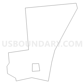
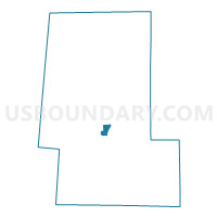
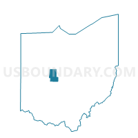
Voting District MARYSVILLE 9, Union County, Ohio
About
Outline
Summary
| Unique Area Identifier | 652882 |
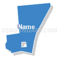
| Name | Voting District MARYSVILLE 9 |
| County | Union County |
| State | Ohio |
| Area (square miles) | 1.08 |
| Land Area (square miles) | 1.05 |
| Water Area (square miles) | 0.03 |
| % of Land Area | 97.26 |
| % of Water Area | 2.74 |
| Latitude of the Internal Point | 40.26309120 |
| Longtitude of the Internal Point | -83.36912680 |
Maps

Graphs
Select a template below for downloading or customizing gragh for Voting District MARYSVILLE 9, Union County, Ohio


Neighbors
Neighoring Voting District (by Name) Neighboring Voting District on the Map
- Voting District MARYSVILLE 1, Union County, OH
- Voting District MARYSVILLE 13, Union County, OH
- Voting District MARYSVILLE 14, Union County, OH
- Voting District MARYSVILLE 4, Union County, OH
- Voting District PARIS 1, Union County, OH
- Voting District PARIS 2, Union County, OH